
Vietnam’s Loneliest Road: Ho Chi Minh Trail West Branch
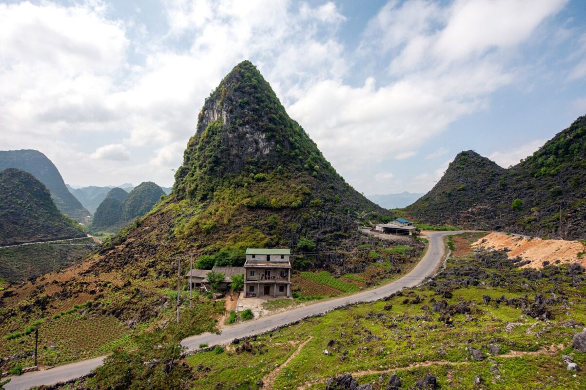
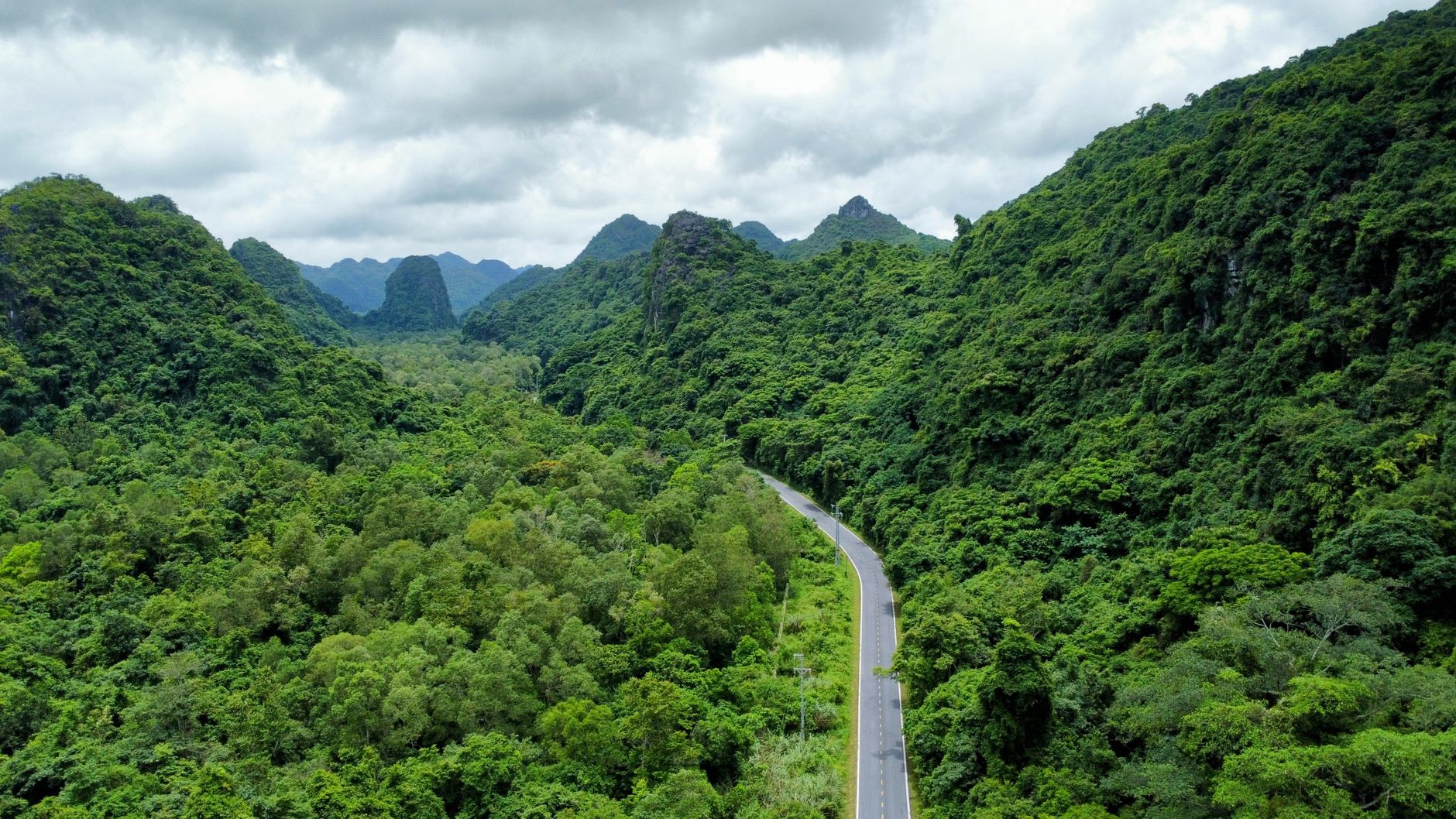
The loneliest road in this story is the western branch of the Ho Chi Minh Trail in Quang Tri Province. Moreover, a photo of that empty stretch, titled “Vietnam’s loneliest road,” drew more than 7,000 likes after a Russian traveler shared it in a Facebook group for foreign visitors on Sept. 17.
For travelers, the practical note is simple: this route rewards slow driving, early starts, and a flexible day near Phong Nha-Ke Bang.
Loneliest Road on the map
Anatolii Kusurko, a Russian living in Ho Chi Minh City, took the photo at about 9 a.m. on April 30 while driving with a friend toward Phong Nha-Ke Bang. For instance, the road looked deserted, so he stopped and flew a drone for a higher view. In the frame the road seemed to run endlessly down a steep slope. However, many people who saw the image at first assumed it was AI-generated.
How to place Loneliest Road in your route
The western branch belongs to the historic Truong Son road network. Therefore, it runs about 250 kilometers from Khe Gat Junction in Phong Nha Commune to National Highway 9 in Khe Sanh Commune. Along the way you pass Phong Nha-Ke Bang National Park, Paradise Cave, the Eight Ladies Cave, and Ta Con Airport.
What to expect on the ground
Meanwhile, local drivers describe the road as scenic rather than dangerous in dry weather. Tour driver Nguyen Tu, who has run the route many times, said travelers should mainly avoid it in heavy rain because of landslide risk. For example, tour guide Nguyen Duy Huan, who has traveled the western branch twice, said the quiet stretches are the point: dense forest and limestone cliffs line the drive, and the history of the Truong Son network becomes clearer once you slow down.
Loneliest road driving tips
Use these loneliest road tips when you plan the day. Fuel up before remote segments. Keep headlights on for shared stretches with local trucks. If clouds sit low on the limestone ridge, wait an hour rather than forcing a pass. A simple picnic stop works better than hunting for a perfect viewpoint.
The road surface is sealed on most of the west branch, but side spurs to older trail markers can turn muddy after a short shower. You do not need a 4×4 for the main line in dry season. You do need patience when a logging truck occupies a narrow cut.
Photography works best in the first hours after dawn, when mist lifts from the valleys. Stay on public road edges and ask before photographing people at homes or shrines. Drone use is possible in open sections, though you should keep the aircraft clear of villages and any military or memorial sites.
If you only have one day, combine a short stretch of this loneliest road with one show cave near Phong Nha rather than driving the full 250 kilometers. That mix gives you both the empty-road feeling and a concrete stop with facilities.
Planning notes
Additionally, these few habits keep the day comfortable.
- Start early if you want cooler air and fewer vehicles at viewpoints.
- Check mountain weather before you go; skip the route in heavy rain.
- Download offline maps before signal drops.
- Leave a flexible afternoon near Phong Nha for caves or a short walk.
Planning a trip around the loneliest road? Furthermore, V-International Tour & Travel can help shape a practical Vietnam itinerary. Official visitor information is available from the Vietnam National Authority of Tourism.
Source notes: photo and quotes via VnExpress English travel coverage of Anatolii Kusurko’s “Vietnam’s loneliest road.”